Weather Alert in Florida
Flood Warning issued September 11 at 9:26AM EDT by NWS Melbourne FL
AREAS AFFECTED: Lake, FL; Volusia, FL
DESCRIPTION: ...The Flood Warning continues for the following rivers in Florida... St Johns River Near Astor affecting Lake and Volusia Counties. .On the Saint Johns River Near Astor, recent rainfall over the basin and northerly winds have caused river levels to approach Moderate Flood Stage. The river is forecast to remain near or just below Moderate flood stage into this weekend. However, any additional rainfall may cause further increases in the river levels. For the St. Johns River...including Astor...Moderate flooding is forecast. Additional information is available at www.weather.gov. The next statement will be issued this evening at 1100 PM EDT. * WHAT...Minor flooding is occurring and moderate flooding is forecast. * WHERE...St Johns River near Astor. * WHEN...Until further notice. * IMPACTS...At 3.0 feet, Water approaches or may enter lowest homes on or near Wildhog Road and nearby canals. Flooding reaches the parking lot of the Juno Trail Apartments. Flooding on portions of Alligator Road and Holiday Road. Lowest lying yards along Blue Creek are flooded. Roads at Astor Landing Campground and Lake Dexter Boat Ramp begin to flood. Water enters lower homes closest to the river on McPherson Lane. * ADDITIONAL DETAILS... - At 8:30 AM EDT Thursday the stage was 2.9 feet. - Bankfull stage is 2.0 feet. - Recent Activity...The maximum river stage in the 24 hours ending at 8:30 AM EDT Thursday was 3.0 feet. - Forecast...The river is expected to rise to a crest of 3.0 feet this afternoon. - Flood stage is 2.3 feet. - http://www.weather.gov/safety/flood
INSTRUCTION: N/A
Want more detail? Get the Complete 7 Day and Night Detailed Forecast!
Current U.S. National Radar--Current
The Current National Weather Radar is shown below with a UTC Time (subtract 5 hours from UTC to get Eastern Time).

National Weather Forecast--Current
The Current National Weather Forecast and National Weather Map are shown below.

National Weather Forecast for Tomorrow
Tomorrow National Weather Forecast and Tomorrow National Weather Map are show below.

North America Water Vapor (Moisture)
This map shows recent moisture content over North America. Bright and colored areas show high moisture (ie, clouds); brown indicates very little moisture present; black indicates no moisture.

Weather Topic: What is Condensation?
Home - Education - Precipitation - Condensation
 Next Topic: Contrails
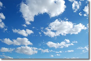
Condensation is the process which creates clouds, and therefore
it is a crucial process in the water cycle.
Condensation is the change of matter from a state of gas into a state of liquid,
and it happens because water molecules release heat into the atmosphere and
become organized into a more closely packed structure, what we might see as
water droplets.
Water is always present in the air around us as a vapor, but it's too small for
us to see. When water undergoes the process of condensation it becomes organized
into visible water droplets. You've probably seen condensation happen before on the
surface of a cold drink!
Next Topic: Contrails
Weather Topic: What are Cumulonimbus Clouds?
Home - Education - Cloud Types - Cumulonimbus Clouds
 Next Topic: Cumulus Clouds
The final form taken by a growing cumulus cloud is the
cumulonimbus cloud, which is very tall and dense.
The tower of a cumulonimbus cloud can soar 23 km into the atmosphere, although
most commonly they stop growing at an altitude of 6 km.
Even small cumulonimbus clouds appear very large in comparison to other cloud types.
They can signal the approach of stormy weather, such as thunderstorms or blizzards.
Next Topic: Cumulus Clouds
Current conditions powered by WeatherAPI.com


