Weather Alert in Texas
Flood Warning issued June 8 at 9:06AM CDT by NWS Houston/Galveston TX
AREAS AFFECTED: Liberty, TX
DESCRIPTION: ...The Flood Warning is extended for the following rivers in Texas... Trinity River at Riverside affecting Polk, Trinity, San Jacinto and Walker Counties. ...The Flood Warning continues for the following rivers in Texas... Trinity River at Liberty affecting Liberty County. Trinity River near Moss Bluff affecting Liberty and Chambers Counties. For the Trinity River...including Crockett, Riverside, Romayor, Goodrich, Moss Bluff, Liberty...Moderate flooding is forecast. * WHAT...Moderate flooding is occurring and moderate flooding is forecast. * WHERE...Trinity River at Liberty. * WHEN...Until further notice. * IMPACTS...At 29.0 feet, Major lowland flooding begins as homes in several subdivisions above Liberty begin flooding. Extensive flooding over much of Liberty County can be expected with each incremental rise in the river. * ADDITIONAL DETAILS... - At 8:15 AM CDT Sunday the stage was 27.7 feet. - Bankfull stage is 21.0 feet. - Recent Activity...The maximum river stage in the 24 hours ending at 8:15 AM CDT Sunday was 27.7 feet. - Forecast...The river is expected to rise to 28.4 feet early Thursday afternoon. Additional rises are possible thereafter. - Flood stage is 26.0 feet. - Flood History...This crest compares to a previous crest of 28.4 feet on 02/11/1992. - http://www.weather.gov/safety/flood
INSTRUCTION: Motorists should not attempt to drive around barricades or drive cars through flooded areas. Turn around, don't drown when encountering flooded roads. Most flood deaths occur in vehicles. Additional information is available at www.weather.gov/hgx. The next statement will be issued Monday morning at 700 AM CDT.
Want more detail? Get the Complete 7 Day and Night Detailed Forecast!
Current U.S. National Radar--Current
The Current National Weather Radar is shown below with a UTC Time (subtract 5 hours from UTC to get Eastern Time).

National Weather Forecast--Current
The Current National Weather Forecast and National Weather Map are shown below.

National Weather Forecast for Tomorrow
Tomorrow National Weather Forecast and Tomorrow National Weather Map are show below.

North America Water Vapor (Moisture)
This map shows recent moisture content over North America. Bright and colored areas show high moisture (ie, clouds); brown indicates very little moisture present; black indicates no moisture.

Weather Topic: What is Drizzle?
Home - Education - Precipitation - Drizzle
 Next Topic: Evaporation
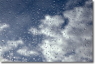
Drizzle is precipitation in the form of water droplets which are
smaller than raindrops.
Drizzle is characterized by fine, gently falling droplets and typically does not
impact human habitation in a negative way. The exception to this is freezing drizzle,
a condition where drizzle freezes immediately upon reaching earth's surface.
Freezing drizzle is still less dangerous than freezing rain, but can
potentially result in hazardous road conditions.
Next Topic: Evaporation
Weather Topic: What is Fog?
Home - Education - Cloud Types - Fog
 Next Topic: Fractus Clouds
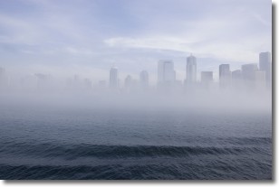
Fog is technically a type of stratus cloud, which lies along the
ground and obscures visibility.
It is usually created when humidity in the air condenses into tiny water droplets.
Because of this, some places are more prone to foggy weather, such as regions
close to a body of water.
Fog is similar to mist; both are the appearance of water droplets suspended in
the air, but fog is the term applied to the condition when visibility is less than 1 km.
Next Topic: Fractus Clouds
Current conditions powered by WeatherAPI.com


