Weather Alert in North Carolina
Severe Thunderstorm Warning issued June 8 at 3:25PM EDT until June 8 at 4:30PM EDT by NWS Newport/Morehead City NC
AREAS AFFECTED: Carteret, NC; Craven, NC; Hyde, NC
DESCRIPTION: SVRMHX The National Weather Service in Newport has issued a * Severe Thunderstorm Warning for... Southeastern Craven County in eastern North Carolina... Southeastern Hyde County in eastern North Carolina... Carteret County in eastern North Carolina... * Until 430 PM EDT. * At 324 PM EDT, severe thunderstorms were located along a line extending from 8 miles northeast of South River to near Bogue Inlet Pier, moving northeast at 45 mph. HAZARD...70 mph wind gusts and half dollar size hail. SOURCE...Radar indicated. IMPACT...Hail damage to vehicles is expected. Expect considerable tree damage. Wind damage is also likely to mobile homes, roofs, and outbuildings. * Locations impacted include... Havelock, Morehead City, Newport, Cedar Island, Harkers Island, South River, Cape Carteret, North River, Sealevel, Marshallberg, Davis, Smyrna, Merrimon, Straits, Atlantic, Pine Knoll Shores, Harlowe, Otway, Broad Creek, and Great Neck.
INSTRUCTION: For your protection move to an interior room on the lowest floor of a building. Please send your reports of hail and/or wind damage, including trees or large limbs downed, by calling the National Weather Service office in Newport at 1-800-889-6889.
Want more detail? Get the Complete 7 Day and Night Detailed Forecast!
Current U.S. National Radar--Current
The Current National Weather Radar is shown below with a UTC Time (subtract 5 hours from UTC to get Eastern Time).

National Weather Forecast--Current
The Current National Weather Forecast and National Weather Map are shown below.

National Weather Forecast for Tomorrow
Tomorrow National Weather Forecast and Tomorrow National Weather Map are show below.

North America Water Vapor (Moisture)
This map shows recent moisture content over North America. Bright and colored areas show high moisture (ie, clouds); brown indicates very little moisture present; black indicates no moisture.

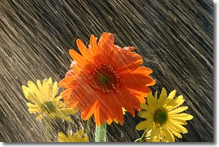
Weather Topic: What is Rain?
Home - Education - Precipitation - Rain
 Next Topic: Shelf Clouds
Precipitation in the form of water droplets is called rain.
Rain generally has a tendency to fall with less intensity over a greater period
of time, and when rainfall is more severe it is usually less sustained.
Rain is the most common form of precipitation and happens with greater frequency
depending on the season and regional influences. Cities have been shown to have
an observable effect on rainfall, due to an effect called the urban heat island.
Compared to upwind, monthly rainfall between twenty and forty miles downwind of
cities is 30% greater.
Next Topic: Shelf Clouds
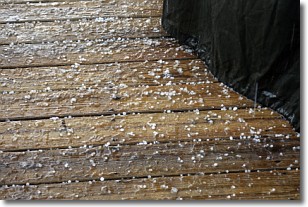
Weather Topic: What is Sleet?
Home - Education - Precipitation - Sleet
 Next Topic: Snow
Sleet is a form of precipitation in which small ice pellets are the primary
components. These ice pellets are smaller and more translucent than hailstones,
and harder than graupel. Sleet is caused by specific atmospheric conditions and
therefore typically doesn't last for extended periods of time.
The condition which leads to sleet formation requires a warmer body of air to be
wedged in between two sub-freezing bodies of air. When snow falls through a warmer
layer of air it melts, and as it falls through the next sub-freezing body of air
it freezes again, forming ice pellets known as sleet. In some cases, water
droplets don't have time to freeze before reaching the surface and the result is
freezing rain.
Next Topic: Snow
Current conditions powered by WeatherAPI.com


