Weather Alert in North Carolina
Severe Thunderstorm Watch issued June 8 at 2:39PM EDT until June 8 at 10:00PM EDT by NWS Wakefield VA
AREAS AFFECTED: Bertie, NC; Camden, NC; Chowan, NC; Currituck, NC; Gates, NC; Hertford, NC; Northampton, NC; Pasquotank, NC; Perquimans, NC; Amelia, VA; Brunswick, VA; Dinwiddie, VA; Greensville, VA; Isle of Wight, VA; Lunenburg, VA; Mecklenburg, VA; Nottoway, VA; Prince Edward, VA; Prince George, VA; Southampton, VA; Surry, VA; Sussex, VA; City of Chesapeake, VA; City of Colonial Heights, VA; City of Emporia, VA; City of Franklin, VA; City of Hopewell, VA; City of Norfolk, VA; City of Petersburg, VA; City of Portsmouth, VA; City of Suffolk, VA; City of Virginia Beach, VA
DESCRIPTION: THE NATIONAL WEATHER SERVICE HAS ISSUED SEVERE THUNDERSTORM WATCH 393 IN EFFECT UNTIL 10 PM EDT THIS EVENING FOR THE FOLLOWING AREAS IN NORTH CAROLINA THIS WATCH INCLUDES 9 COUNTIES IN NORTHEAST NORTH CAROLINA BERTIE CAMDEN CHOWAN CURRITUCK GATES HERTFORD NORTHAMPTON PASQUOTANK PERQUIMANS IN VIRGINIA THIS WATCH INCLUDES 23 COUNTIES IN CENTRAL VIRGINIA AMELIA CITY OF COLONIAL HEIGHTS PRINCE EDWARD IN SOUTH CENTRAL VIRGINIA BRUNSWICK CITY OF HOPEWELL CITY OF PETERSBURG DINWIDDIE LUNENBURG MECKLENBURG NOTTOWAY PRINCE GEORGE IN SOUTHEAST VIRGINIA CITY OF CHESAPEAKE CITY OF EMPORIA CITY OF FRANKLIN CITY OF NORFOLK CITY OF PORTSMOUTH CITY OF SUFFOLK CITY OF VIRGINIA BEACH GREENSVILLE ISLE OF WIGHT SOUTHAMPTON SURRY SUSSEX THIS INCLUDES THE CITIES OF AHOSKIE, AMELIA COURTHOUSE, ANTE, BACONS CASTLE, BARHAM, BOOTH FORK, BOWERS HILL, BOYKINS, BRUNSWICK, BRYANTOWN, BUFFORD CROSSROADS, CAPE COLONY, CHASE CITY, CHESAPEAKE AIRPORT, CHIPPOKES STATE PARK, CHULA, CLARESVILLE, CLARKSVILLE, COLONIAL HEIGHTS, COURTLAND, COWIE CORNER, CREWE, CURRITUCK, DEEP CREEK, DENARO, DURAND, EAGLETOWN, EARLS, EDENHOUSE, EDENTON, EDGERTON, ELIZABETH CITY, EMPORIA, EMPORIA AIRPORT, EMPORIA RESERVOIR, FARMVILLE, FENTRESS, FORT LEE, FRANKLIN, GARYSBURG, GASTON, GATESVILLE, GREAT BRIDGE, GREEN PLAIN, GREENBRIER, GUM FORKS, GWALTNEY CORNER, HANCOCK, HERTFORD, HOG ISLAND GAME RESERVE, HOPEWELL, HORSESHOE, HUNTERDALE, IVOR, JETERSVILLE, KENBRIDGE, LAWRENCEVILLE, LILLY, MACEDONIA, MANNBORO, MAVATON, MERRY HILL, MIDWAY, MOUNT PLEASANT, NORFOLK, PETERSBURG, POOLESVILLE, PORTSMOUTH, QUITSNA, REAMS, RICH SQUARE, SAINT JOHNS, SCOTTS FORK, SHARON, SMITHFIELD, SOUTH HILL, SUFFOLK, TRIPLET, VALENTINES, VALHALLA, VICTORIA, VIRGINIA BEACH, VULTARE, WAKEFIELD, WAVERLY, WHITE PLAINS, AND WINDSOR.
INSTRUCTION: N/A
Want more detail? Get the Complete 7 Day and Night Detailed Forecast!
Current U.S. National Radar--Current
The Current National Weather Radar is shown below with a UTC Time (subtract 5 hours from UTC to get Eastern Time).

National Weather Forecast--Current
The Current National Weather Forecast and National Weather Map are shown below.

National Weather Forecast for Tomorrow
Tomorrow National Weather Forecast and Tomorrow National Weather Map are show below.

North America Water Vapor (Moisture)
This map shows recent moisture content over North America. Bright and colored areas show high moisture (ie, clouds); brown indicates very little moisture present; black indicates no moisture.

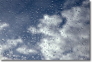
Weather Topic: What is Drizzle?
Home - Education - Precipitation - Drizzle
 Next Topic: Evaporation
Drizzle is precipitation in the form of water droplets which are
smaller than raindrops.
Drizzle is characterized by fine, gently falling droplets and typically does not
impact human habitation in a negative way. The exception to this is freezing drizzle,
a condition where drizzle freezes immediately upon reaching earth's surface.
Freezing drizzle is still less dangerous than freezing rain, but can
potentially result in hazardous road conditions.
Next Topic: Evaporation
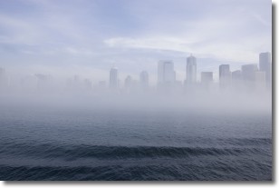
Weather Topic: What is Fog?
Home - Education - Cloud Types - Fog
 Next Topic: Fractus Clouds
Fog is technically a type of stratus cloud, which lies along the
ground and obscures visibility.
It is usually created when humidity in the air condenses into tiny water droplets.
Because of this, some places are more prone to foggy weather, such as regions
close to a body of water.
Fog is similar to mist; both are the appearance of water droplets suspended in
the air, but fog is the term applied to the condition when visibility is less than 1 km.
Next Topic: Fractus Clouds
Current conditions powered by WeatherAPI.com


