Weather Alert in South Carolina
Coastal Flood Advisory issued April 27 at 10:09AM EDT until April 27 at 10:00PM EDT by NWS Charleston SC
AREAS AFFECTED: Coastal Colleton; Charleston
DESCRIPTION: * WHAT...For the High Rip Current Risk, dangerous rip currents. For the Coastal Flood Advisory, up to one foot of inundation above ground level expected along shorelines and tidal waterways (7.4 to 7.6 feet Mean Lower Low Water at Charleston). * WHERE...Coastal Colleton and Charleston Counties. * WHEN...For the High Rip Current Risk, until 8 PM EDT this evening. For the Coastal Flood Advisory, from 7 PM to 10 PM EDT this evening. * IMPACTS...This will result in some roads becoming impassable and minor flooding of properties. Rip currents can sweep even the best swimmers away from shore into deeper water. * ADDITIONAL DETAILS...High tide will occur around 8:07 AM today at Charleston. Saltwater inundation will be possible 1 to 2 hours before and after high tide.
INSTRUCTION: If travel is required, allow extra time as some roads may be closed. Do not drive around barricades or through water of unknown depth. Take the necessary actions to protect flood-prone property. Visit water.weather.gov for additional water level and flood impact information. Swim near a lifeguard. If caught in a rip current, relax and float. Don't swim against the current. If able, swim in a direction following the shoreline. If unable to escape, face the shore and call or wave for help.
Want more detail? Get the Complete 7 Day and Night Detailed Forecast!
Current U.S. National Radar--Current
The Current National Weather Radar is shown below with a UTC Time (subtract 5 hours from UTC to get Eastern Time).

National Weather Forecast--Current
The Current National Weather Forecast and National Weather Map are shown below.

National Weather Forecast for Tomorrow
Tomorrow National Weather Forecast and Tomorrow National Weather Map are show below.

North America Water Vapor (Moisture)
This map shows recent moisture content over North America. Bright and colored areas show high moisture (ie, clouds); brown indicates very little moisture present; black indicates no moisture.

Weather Topic: What are Cumulonimbus Clouds?
Home - Education - Cloud Types - Cumulonimbus Clouds
 Next Topic: Cumulus Clouds
The final form taken by a growing cumulus cloud is the
cumulonimbus cloud, which is very tall and dense.
The tower of a cumulonimbus cloud can soar 23 km into the atmosphere, although
most commonly they stop growing at an altitude of 6 km.
Even small cumulonimbus clouds appear very large in comparison to other cloud types.
They can signal the approach of stormy weather, such as thunderstorms or blizzards.
Next Topic: Cumulus Clouds
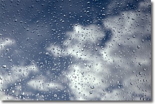
Weather Topic: What is Drizzle?
Home - Education - Precipitation - Drizzle
 Next Topic: Evaporation
Drizzle is precipitation in the form of water droplets which are
smaller than raindrops.
Drizzle is characterized by fine, gently falling droplets and typically does not
impact human habitation in a negative way. The exception to this is freezing drizzle,
a condition where drizzle freezes immediately upon reaching earth's surface.
Freezing drizzle is still less dangerous than freezing rain, but can
potentially result in hazardous road conditions.
Next Topic: Evaporation
Current conditions powered by WeatherAPI.com


